
News Summary
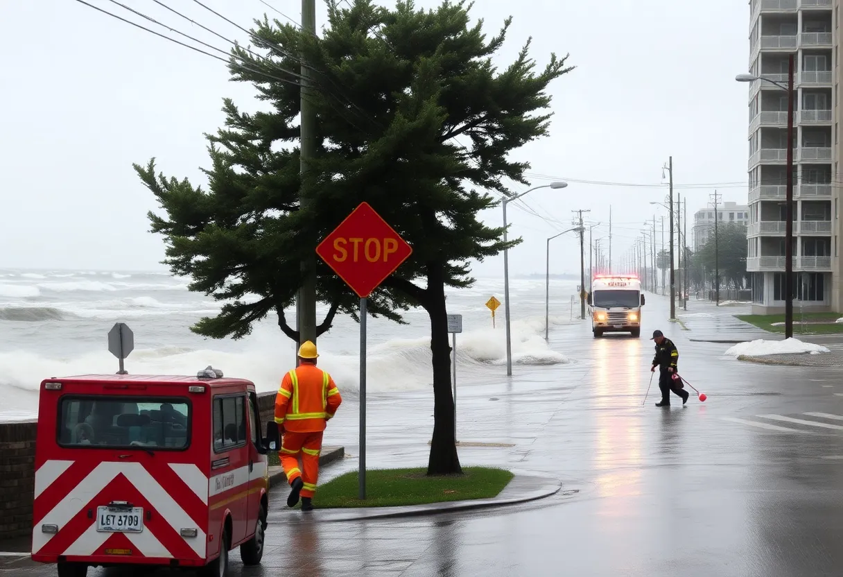
Hurricane Erin is causing significant flooding and evacuation orders in New Jersey, particularly in Egg Harbor Township and Atlantic City. Coastal flood warnings have been issued for several counties, predicting high waves and inland flooding. Local authorities are on alert, with swimming bans in place along the Jersey Shore due to hazardous surf conditions. Residents are encouraged to stay safe and informed as the hurricane continues to affect the region, with the potential for moderate coastal flooding and hazardous weather expected through the weekend.
Evacuations and Flood Warnings as Hurricane Erin Hits New Jersey
Residents of Egg Harbor Township, Atlantic County are facing an urgent situation as evacuations are currently underway due to significant flooding caused by Hurricane Erin. Many guests in motels and residents living in low-lying areas are being asked to leave their homes as water levels rise. Police Chief Frederick Spano has reported notable flooding in West Atlantic City, where floodwaters are creepily getting closer to several houses.
While no evacuations have been ordered yet in Wildwood, it’s essential to note that Rio Grande Avenue has been closed off as a precaution due to high floodwaters. Flooding issues are not confined to just one area; multiple locations including Long Beach Island, Atlantic City, Ocean City, Manasquan, Margate City, and other Jersey Shore spots are witnessing similar problems.
Coastal Flood Warnings Galore
The authorities have issued coastal flood warnings ahead of Hurricane Erin, anticipating high waves that may push as much as 2 to 3 feet of ocean water inland along the coast, leading to substantial flooding issues. These warnings will remain in effect through Saturday for counties such as Atlantic, Burlington, Cape May, Cumberland, Middlesex, Monmouth, and Ocean.
In addition to the warnings, flood advisories are also in place through Saturday for Camden, Essex, Gloucester, Hudson, Middlesex, Salem, and Union counties. And don’t forget about the wind advisories currently in effect from 10 a.m. Thursday until midnight Friday specifically for Atlantic and Ocean counties.
Your Weekend Forecast: Keep an Eye on the Waves
Interestingly, this hurricane marks the first Atlantic hurricane of 2025, having formed on August 11 near the Cabo Verde Islands. Though it isn’t making landfall, it’s still causing rip tides, high waves, and possible flooding as it continues its journey northward. Governor Phil Murphy has already declared a state of emergency as of Thursday afternoon and warns that the worst impacts will likely happen through Friday.
Due to hazardous conditions, more than a dozen Jersey Shore beaches have imposed swimming bans to ensure public safety. As per experts from the National Weather Service, Hurricane Erin could bring about some of the roughest surf conditions that the Jersey Shore has seen since Tropical Storm Isaias back in August 2020. Wave heights farther offshore could potentially reach up to 15 to 17 feet, which poses serious risks to small boats.
What Residents Should Expect
Moderate coastal flooding is expected to peak during the high tide on Thursday night, and officials in Atlantic City are prepared for street flooding during that time. Roads such as Dorset Ave. and Wellington Ave., along with Route 40, are expected to face closure due to floodwaters.
Beach erosion is another concern, and special pumps are all set to operate to drain water off the islands as needed. High-water vehicles and flat-bottom boats are on standby should they be required for rescue or transport operations.
In light of the conditions, it’s crucial for residents to maintain a high level of situational awareness. For the safety of everyone involved, the ocean is closed for swimming until at least Friday. Lifeguards have reported multiple rescues as beach-goers attempted to swim in the dangerous surf conditions. Many opt to stick to the safer areas, watching the storm surge from piers and boardwalks rather than venturing into the water.
Stay Safe Out There!
As Hurricane Erin continues to influence weather patterns, it’s vital that everyone stays informed and prepared. Whether you’re evacuating or just monitoring the situation from a safe place, remember to look out for one another and always prioritize safety first!
Deeper Dive: News & Info About This Topic
- NJ.com: Hurricane Erin Causes Flooding
- Wikipedia: Hurricane Erin
- ABC 6: Jersey Shore Braces for Hurricane Erin
- Google Search: Hurricane Erin
- Press of Atlantic City: Local News on Hurricane Erin
- Google Scholar: Hurricane Erin
- Cat Country 107.3: Swimming Ban in Wildwood
- Encyclopedia Britannica: Hurricane Erin
- WPG Talk Radio: Hurricane Erin in Brigantine
- Google News: Hurricane Erin New Jersey

Author: STAFF HERE WILLIAMSBURG WRITER
The WILLIAMSBURG STAFF WRITER represents the experienced team at HEREWilliamsburg.com, your go-to source for actionable local news and information in Williamsburg, James City County, and beyond. Specializing in "news you can use," we cover essential topics like product reviews for personal and business needs, local business directories, politics, real estate trends, neighborhood insights, and state news affecting the area—with deep expertise drawn from years of dedicated reporting and strong community input, including local press releases and business updates. We deliver top reporting on high-value events such as Williamsburg Farmers Market, Yorktown Market Days, and Busch Gardens Food & Wine Festival. Our coverage extends to key organizations like the Greater Williamsburg Chamber of Commerce and Colonial Williamsburg Foundation, plus leading businesses in education and hospitality that power the local economy such as College of William & Mary, The Williamsburg Winery, and Sodexo. As part of the broader HERE network, including HEREVirginiaBeach.com, we provide comprehensive, credible insights into Virginia's dynamic landscape.