
News Summary
A new map reveals the extraordinary features of the Delaware River at Narrowsburg, NY, particularly highlighting the Big Eddy Narrows, which reaches depths of 113 feet. Created by cartographer Lisa Glover, this map offers insights into the underwater geography of the region and aims to educate locals and visitors alike. Glover’s work supports the Upper Delaware Council and provides an opportunity for explorers to learn about the river’s historical significance and natural beauty. The eye-catching map is available in poster format, promising to pique interest in the local ecological wonders.
Discovering the Hidden Depths of the Delaware River at Narrowsburg, NY
Have you ever wondered about the hidden treasures lurking beneath the surface of the rivers we know and love? Well, if you’re near Narrowsburg, NY, you might want to pay extra attention because a brand-new map has just revealed some **incredible** features of the renowned Delaware River. Nestled at the foot of the majestic Catskills in Sullivan County, Narrowsburg is home to the widest and deepest part of the 330-mile Delaware River, which flows all the way to the **Delaware Bay**.
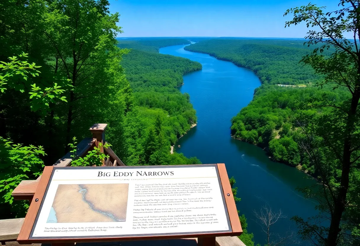
Introducing the Big Eddy Narrows
The spotlight of the new mapping revelation is the “**Big Eddy Narrows**,” which features a breathtaking depth of **113 feet** at **River Mile 290**. This depth is particularly striking, considering that the Delaware River has an average depth of only four to five feet, with pockets of **12 to 18 feet** depth sprinkled throughout. Remarkably, light does not even reach the bottom of the Big Eddy even during daylight!
Meet the Map Creator
The mastermind behind this exciting cartographic work is Lisa Glover, an artist and cartographer from Honesdale. Inspired by the unique features of the Delaware River, Glover created this map to support the non-profit Upper Delaware Council (UDC). Through her hard work, locals and visitors can now explore the fascinating underwater geography of the area.
Educational Opportunities Await
The map is available in an eye-catching 11-by-17-inch poster format and can be found adorning the walls of many local establishments. An interpretative sign is also available at the **Big Eddy Observation Deck** located on Main Street in Narrowsburg. This sign offers additional insights about the Big Eddy and its geological formations.
Theories Behind the Depth
So, how did this astonishing **113-foot hole** come into existence? Experts have two theories: it could either be a long-drowned “plunge pool” resulting from a glacial waterfall or a pothole shaped by the relentless erosion of rocks over thousands of years. If you’re lucky during your visit, you might even catch sight of a **whirlpool** swirling at the location of the deepest part of the river!
Historical Significance
The depth of the river has historical significance as well. In **February 1873**, locals took soundings and documented the river’s depth at 101 feet. Historical accounts note that log rafts often got caught in the Big Eddy, leading to significant delays and messy traffic jams on the river!
The Power of Technology
Glover utilized advanced technologies to create this map. She accessed a digital map focused specifically on the **Big Eddy** region from the U.S. Geological Survey (USGS), which conducted a LiDAR scan of the Delaware River in 2020. Thanks to this tech-savvy approach, the map features detailed topobathymetric illustrations showcasing underwater landforms in exquisite detail.
Supporting Local Initiatives
In total, Glover printed **50 copies** of her detailed and informative maps, which supporters can acquire for a **$20 donation** to the UDC. And don’t worry if you can’t swing by in person—she also offers mail orders with a small additional fee for shipping! Donations can be made via cash or check.
A Rich Community Connection
Glover is not only talented but also community-oriented. She’s affiliated with multiple organizations, including Highlights for Children and the Wayne County Arts Alliance. Holding degrees in architecture and engineering from Lehigh University, she brings her unique expertise to her cartography, enriching the experience of those who visit the area.
So, whether you’re planning a day trip or just looking to learn a little more about the remarkable **Delaware River**, you might want to check out this new map and dive into the depths of history and natural wonder just waiting to be explored!
Deeper Dive: News & Info About This Topic
- River Reporter: Narrowsburg Park Dedicated
- LoHud: Little-known Towns in New York
- River Reporter: Youth News Ambassador Meetings
- Google Search: Delaware River geography
- Encyclopedia Britannica: Delaware River

Author: STAFF HERE WILLIAMSBURG WRITER
The WILLIAMSBURG STAFF WRITER represents the experienced team at HEREWilliamsburg.com, your go-to source for actionable local news and information in Williamsburg, James City County, and beyond. Specializing in "news you can use," we cover essential topics like product reviews for personal and business needs, local business directories, politics, real estate trends, neighborhood insights, and state news affecting the area—with deep expertise drawn from years of dedicated reporting and strong community input, including local press releases and business updates. We deliver top reporting on high-value events such as Williamsburg Farmers Market, Yorktown Market Days, and Busch Gardens Food & Wine Festival. Our coverage extends to key organizations like the Greater Williamsburg Chamber of Commerce and Colonial Williamsburg Foundation, plus leading businesses in education and hospitality that power the local economy such as College of William & Mary, The Williamsburg Winery, and Sodexo. As part of the broader HERE network, including HEREVirginiaBeach.com, we provide comprehensive, credible insights into Virginia's dynamic landscape.