
News Summary
Virginia residents are warned to prepare for severe thunderstorms this evening, with potential damaging winds and hail. The National Weather Service has issued alerts for scattered storms across central and southeastern Virginia, particularly impacting travel and outdoor activities. A flash flood warning is also in effect for several areas, emphasizing the risks of flooding. As conditions evolve, residents are advised to stay informed and prioritize safety during this severe weather event.
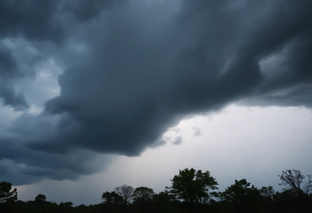
Virginia is bracing for severe thunderstorms tonight, with the National Weather Service (NWS) warning of potential damaging winds and hail. Scattered thunderstorms are expected to move through the central and southeastern parts of the state between 5 and 9 p.m., which may significantly impact evening travel and outdoor activities.
The NWS in Wakefield has indicated that a cold front moving in from the northwest will serve as the catalyst for isolated strong to severe storms later today. Most of Virginia falls under a Marginal Risk (Level 1 of 5) for severe weather, meaning there is a possibility of isolated incidents of severe weather occurring.
The primary dangers associated with tonight’s storms include wind gusts that could reach up to 60 mph and hail that may be as large as a quarter. The areas anticipated to see the most active storms include Richmond, Louisa, Farmville, South Hill, and Wakefield. However, the likelihood of severe conditions diminishes as one moves toward Virginia Beach and the Eastern Shore.
Advisories and Warnings
Rain is expected to continue into the overnight hours, although the intensity of the storms is predicted to decrease after 9 p.m. The NWS has issued an updated flash flood warning effective until 7:15 p.m. for areas including Chesterfield, Henrico, and several counties in the Richmond area. Doppler radar has indicated substantial rainfall in the warned region, with between 0.5 and 1.5 inches already recorded and an additional inch possible.
With the flash flood warning in place, residents are cautioned against driving on flooded roads, as most flood-related deaths occur in vehicles. A flash flood warning signifies that a flash flood is either imminent or already occurring. In addition to the flash flood warning, a severe thunderstorm watch has been issued until 9 p.m. for multiple counties, including Richmond, indicating the potential for damaging winds and minor hail.
Current Conditions and Advice
Reports have emerged of fallen trees in Buckingham, Chesterfield, and Cumberland counties, alongside reports of quarter-sized hail falling in Chesterfield County. Thunderstorms have already reached far northwestern counties, bringing gusty winds and hail. Wind gusts of 30-40 mph are anticipated as the cold front moves through the region.
As a precaution, drivers are advised to avoid flooded roads and remain vigilant for downed trees or potential power outages caused by the strong winds. Residents are encouraged to secure outdoor items and delay any evening travel plans if possible. Showers may persist into early Friday, but the threat of severe storms is expected to end overnight.
Looking Ahead
Continuous updates will be provided by the NWS as conditions evolve throughout the evening. Residents are urged to stay informed and take appropriate safety measures as the storms approach.
Deeper Dive: News & Info About This Topic
- WTVR: Today’s Forecast – Richmond, Virginia May 4, 2025
- Wikipedia: Weather warning
- WRIC: Severe Thunderstorm Warning for Central Virginia
- Google Search: Severe Thunderstorm Virginia
- Richmond.com: Virginia Weather Update
- Google Scholar: Severe Weather Virginia
- 12 On Your Side: First Alert Weather Day – Severe Storm Threat
- Encyclopedia Britannica: Thunderstorm
- Weather.com: Richmond, VA Weather
- Google News: Virginia Weather

Author: STAFF HERE WILLIAMSBURG WRITER
The WILLIAMSBURG STAFF WRITER represents the experienced team at HEREWilliamsburg.com, your go-to source for actionable local news and information in Williamsburg, James City County, and beyond. Specializing in "news you can use," we cover essential topics like product reviews for personal and business needs, local business directories, politics, real estate trends, neighborhood insights, and state news affecting the area—with deep expertise drawn from years of dedicated reporting and strong community input, including local press releases and business updates. We deliver top reporting on high-value events such as Williamsburg Farmers Market, Yorktown Market Days, and Busch Gardens Food & Wine Festival. Our coverage extends to key organizations like the Greater Williamsburg Chamber of Commerce and Colonial Williamsburg Foundation, plus leading businesses in education and hospitality that power the local economy such as College of William & Mary, The Williamsburg Winery, and Sodexo. As part of the broader HERE network, including HEREVirginiaBeach.com, we provide comprehensive, credible insights into Virginia's dynamic landscape.